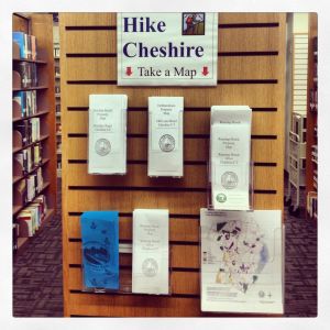
The Cheshire Library has trail maps for four town owned properties. Copies are located on the Main Level on a stack end cap under a Hike Cheshire sign, and on the Lower Level next to the travel books. The maps are for:
 Roaring Brook Property on Roaring Brook Drive. The second tallest waterfall in the state, Roaring Brook Falls also features several cascades below the main drop. The trail is well marked in blue and easy to follow. There is a steady uphill grade from the start and a few rocky downhill parts. The trail gets progressively steeper as you approach the falls.
Boulder Knoll Property on Boulder Road. The open terrain is comprised of flat to rolling fields and hills that climb to a minor basalt/traprock ridge. Portions of the open fields are wet meadow, which is the fastest declining type of wetland in New England.
 Farmington Canal Linear Park. The Cheshire portion of the Farmington Canal Trail – which some day will connect New Haven to Northampton, MA – extends from Cornwall Avenue, south to the Hamden town line, then continuing into Hamden.
The DeDominicis Property on Old Lane Road. Streams and wetlands are scattered throughout this 185 acres of unfragmented forest that features a rich assortment of plant and animal life. The significant acreage and the close proximity to existing open space parcels also make it a desirable habitat for wildlife. Hawks, deer, owls, and other animals can be regularly seen on the property.
